Using Te Ara -
The Encyclopedia of New Zealand
1. Waitemata Harbour
L.I. Develop our knowledge of Auckland and the Tamaki River.
Familiarise ourselves with an online NZ encyclopaedia.
Use our skimming and scanning skills.
Enter Waitemata into the search box and use that page to answer these questions.
What sort of landform is the Waitemata harbour? The Waitemata Harbour is a drowned river valley. ✔
Why was it chosen to be New Zealand’s capital? It was chosen because it had a deep water and sheltered bays. ✔
What does Waitemata mean? It means Auckland Harbour.
Tell me one interesting fact about each of these features of the Waitemata:
Auckland’s chief port - Auckland’s port on the Waitemata was important to the progress of the city and region. ✔
Viaduct basin - The Viaduct Basin, was opened in the mid 1990s. ✔
Westhaven - The largest managed Marina. ✔
Harbour bridge - The Harbour Bridge is to be known as a bridge in Auckland City. The bridge is 1,020 m long, and also was opened in 1959. ✔
Greenhithe bridge - The Greenhithe bridge opened 1975. ✔
Natural features - The Pollen Island Marine Reserve (Motu Manawa) on the northern side of the north-west motorway is the best Auckland example of mangrove saltmarsh. ✔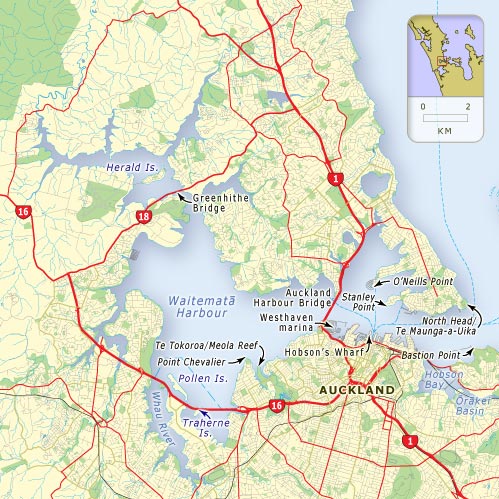
This is what we had to do. I didn't need anybodies help. Oh no I did. From Kapri Haumaha.
0 comments:
Post a Comment
Note: only a member of this blog may post a comment.